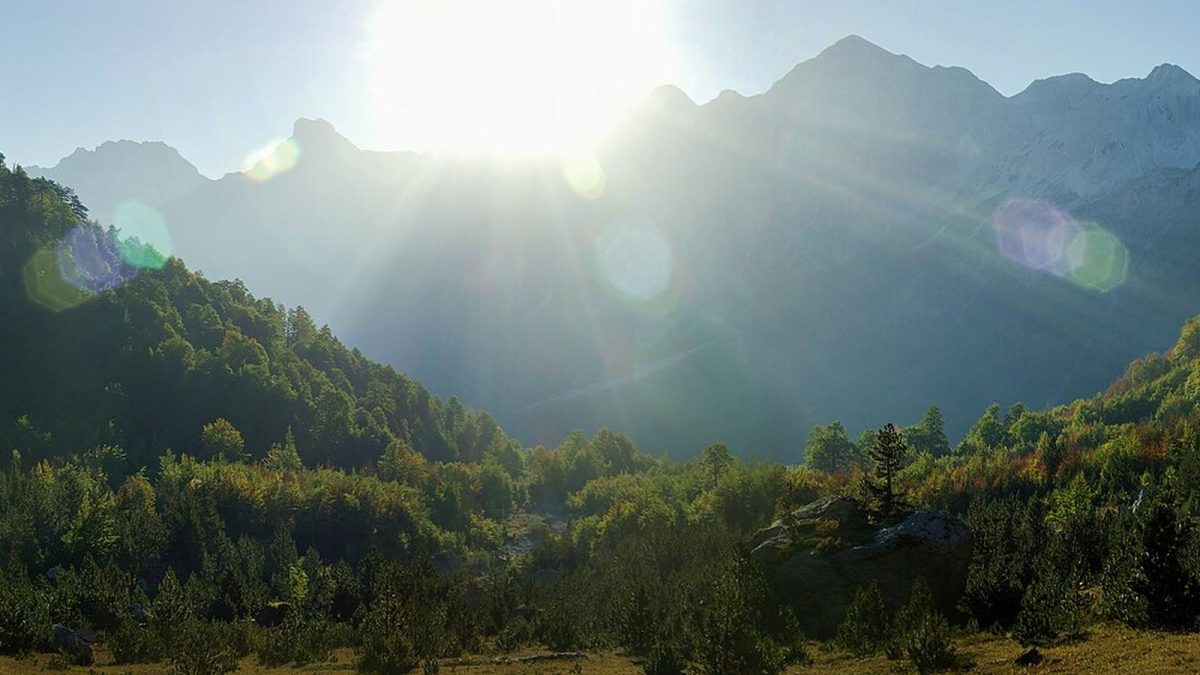
The Peaks of the Balkans is a marked long-distance trail through the Accursed Mountains (Bjeshkët e Nemuna / Prokletije), one of the wildest ranges in Europe. Developed with international support in the early 2010s to bring sustainable tourism to remote villages, it has become one of the best-known hikes in the Balkans.
- Length: roughly 190 km in a loop, usually walked in 10–13 days.
- Countries: Albania, Kosovo and Montenegro, crossing borders on mountain paths.
- Season: about mid-June to late September; snow can block high passes outside that window.
- Accommodation: village guesthouses with dinner and breakfast; camping is possible in places.
- Paperwork: a cross-border permit must be arranged in advance.
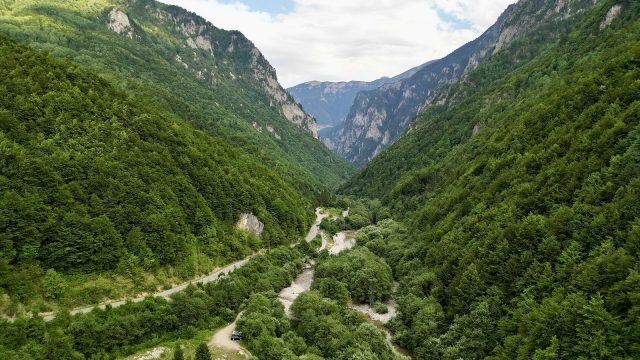
Walking it means limestone peaks, glacial valleys, high shepherd settlements, cold springs and evenings in family-run guesthouses where dinner is grown or made a few metres from the table.
The route, stage by stage
The trail is a loop, so you can join at several points. A commonly walked direction, starting in Albania, looks like this:
- Theth (Albania): a valley village with a famous lock-in tower and waterfall.
- Valbona (Albania): reached over the Valbona Pass, one of the most scenic days of the trek.
- Çerem and Doberdol (Albania): remote high pastures near the borders.
- Milishevc and Rugova (Kosovo): wide alpine meadows and then the Rugova valley near Peja.
- Babino Polje / Plav and Gusinje (Montenegro): lakes, the Grebaje valley and the Prokletije National Park.
- Vusanje and the Pejë Pass back to Theth: closing the loop into Albania.
Daily stages are typically 15–25 km with significant climbs and descents. Several variants and shortcuts exist, so it is easy to tailor the trip to fewer days.
Cross-border permits
Because the trail crosses international borders away from official crossing points, hikers need permission in advance from the police authorities of the countries involved. In practice, most people arrange this through a local tour operator or guesthouse network, which submits passport details and the planned dates. Allow several weeks for processing, carry printed copies, and keep your passport with you. Rules can change, so confirm the current procedure before you go.
Important: walking across these borders without a permit can lead to fines or problems when you later leave the country through an official crossing. Do not skip this step.
Guided or self-guided?
- Guided group: a guide, bag transfers and accommodation are arranged. Best for first-time trekkers or those without navigation experience.
- Self-guided package: an operator books guesthouses, permits and often luggage transport, and gives you maps and GPS tracks. A popular middle option.
- Independent: you organise everything yourself. Waymarking has improved, but some sections are faint, and mobile coverage is patchy. Carry offline maps and a GPS track.
Where you sleep and eat
The trail is built around guesthouses (bujtina in Albanian). Expect simple, clean rooms, sometimes shared, and generous home cooking: fresh cheese, bread, beans, grilled meat, garden vegetables, honey and mountain tea. Many guesthouses can prepare a packed lunch for the next day. In peak summer, book ahead, the most popular villages fill up.
When to go
| Period | Conditions |
|---|---|
| Early–mid June | Green valleys and wildflowers; snow may remain on high passes. |
| July–August | Most reliable weather and busiest season; afternoon thunderstorms are common. |
| September | Stable weather, fewer people, colder nights; some guesthouses close late in the month. |
What to pack
- Broken-in hiking boots with good grip.
- Layers, including a warm jacket and waterproof shell; temperatures drop sharply at altitude.
- Sun protection: hat, sunglasses and high-factor sunscreen.
- Water purification tablets or a filter; springs are frequent but not always reliable.
- Offline maps (and a charged power bank), a small first-aid kit, cash in euros and Albanian lek.
Getting there
Common starting points are Shkodër in Albania (for Theth), Peja in Kosovo (for Rugova) and Plav or Gusinje in Montenegro. Shkodër is reached easily from Tirana; Peja from Pristina; and Plav from Podgorica. Minibuses run to the trailheads in summer, and guesthouses can often arrange transfers.
Is it hard?
The Peaks of the Balkans is not technical (no climbing skills are needed) but it is physically demanding. Daily ascents of 800–1,200 metres are common. If you are a fit walker comfortable with full days on mountain paths, it is very achievable; if not, consider walking a shorter section, such as Theth to Valbona, which is a classic hike in its own right.
Whatever you choose, the reward is a part of Europe that still feels remote: high meadows with no road in sight, shepherds moving flocks, and evenings in villages where travellers are welcomed as guests.
Sources and further reading: Peaks of the Balkans official information (peaksofthebalkans.com); national park authorities of Valbona Valley (Albania), Bjeshkët e Nemuna (Kosovo) and Prokletije (Montenegro).